Bidspirit auction | Colton, J. H. – [ÁFRICA].
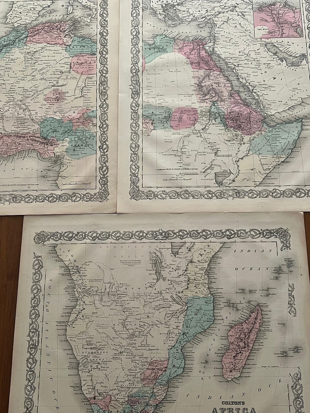
Colton, J. H. – [ÁFRICA]. New York. J.H. Colton and Company. 1855. 3 Litograph Maps and Hand Coloured. 37,5 cm x 45,0 cm each. Loose sheets. - Notable set of three lithographed maps of Africa, executed by the celebrated American cartographer Joseph Hutchins Colton and published by his firm in New York. Joseph Hutchins Colton, founder of the cartographic publishing house, was one of the most prolific and influential map publishers in the United States in the nineteenth century, having begun his activity in 1833 and consolidated his reputation in the following decades with the publication of atlases and separate maps of exceptional technical and aesthetic quality. The present maps, dated 1855, represent the African continent at a crucial moment in the history of exploration and cartography. The mid-nineteenth century corresponds to the period in which European powers intensified their expeditions into the interior of Africa, gradually revealing the geography of a continent until then largely unknown to Westerners. Cartographers such as Colton relied on the accounts of explorers, missionaries and traders to constantly update their representations, resulting in maps that document the state of geographical knowledge in an era of rapid discoveries. Colton's cartography is distinguished by its exquisite technical execution and generous use of color. The maps were lithographed and then hand-colored, a technique that allowed clear distinction between different political or geographical regions through washes in pastel tones of pink, green, yellow and blue. The decorative borders that surround the maps, ornamented with the characteristic geometric spiral that became Colton's distinctive mark, give the pieces a simultaneously scientific and decorative character. The three maps in the present set represent different aspects or regions of the African continent, allowing a comprehensive view of African cartography in the 1850s. At this time, vast areas of the interior remained designated as ”unexplored” or simply left blank, testifying to the extent of European ignorance. The coastal regions, by contrast, were already mapped in detail, reflecting centuries of commercial contact. The maps present themselves loose, in individual sheets, as they were sold both separately and bound in Colton's atlases. The paper, of good quality, exhibits the natural browning of the years, with slight uniform darkening. The colors remain vibrant and well preserved, although some areas of slight fading are detected. Folding creases are observed, particularly visible in the center of some maps, suggesting they were folded for storage at some point in their history. Small scattered foxing spots and light moisture stains on the margins do not compromise the reading or aesthetic appreciation of the maps. The decorative borders remain intact. Set of both cartographic and decorative interest, representative of the excellent production of the house of Colton in the mid-nineteenth century, the golden age of American cartography.