Bidspirit auction | Colton, G. Woolworth – NEW
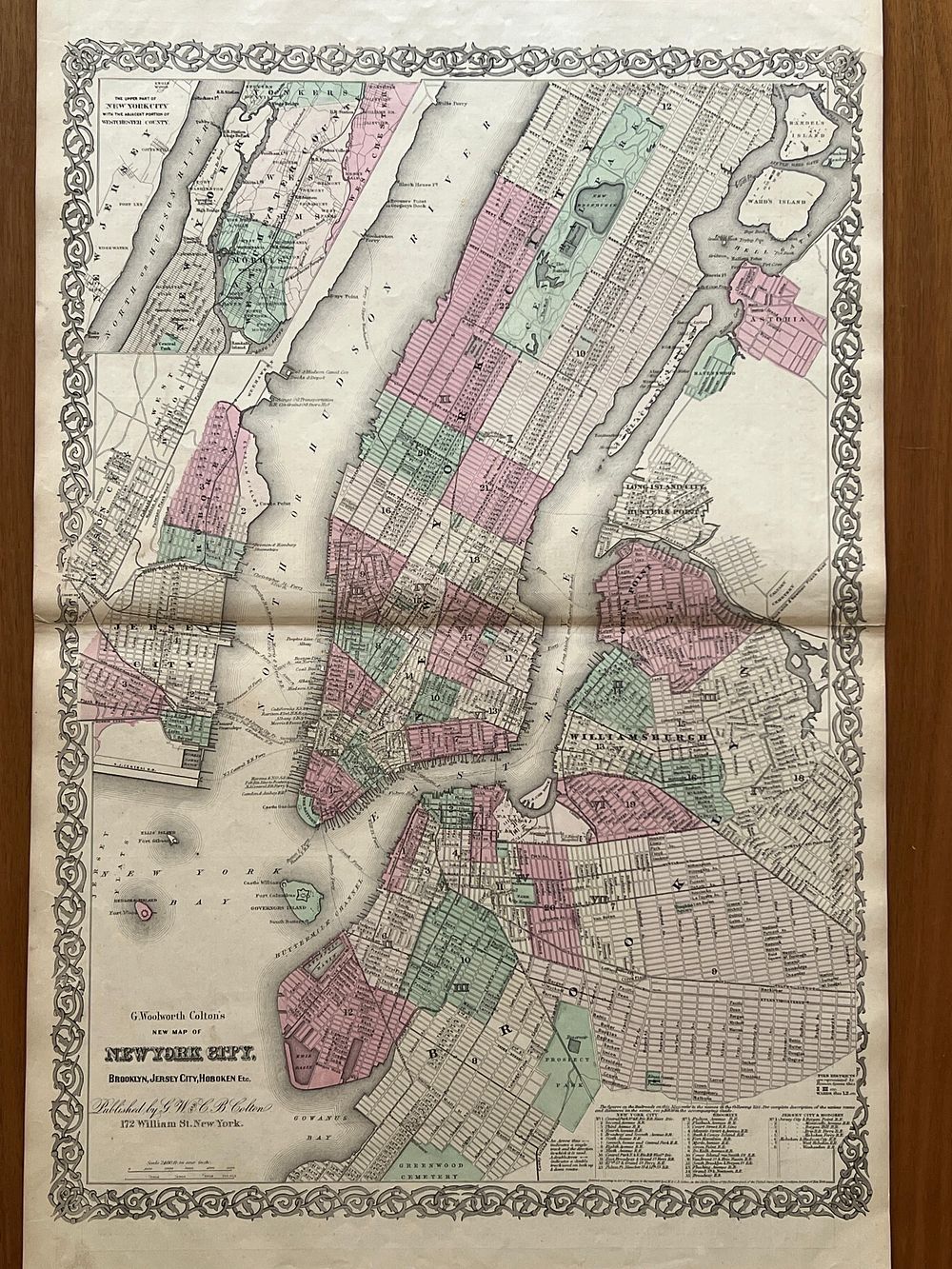
Colton, G. Woolworth – NEW YORK CITY, BROOKLYN, JERSEY CITY, HOBOKEN, ETC. [From] Colton's General Atlas. New York. G.W. s C.B. Colton s Co. 1866. Litograph Map and Hand Coloured. 66,0 cm x 45,0 cm. Single. - Magnificent large-format map representing the city of New York, extracted from the celebrated Colton's General Atlas in its 1866 edition, published by G.W. & C.B. Colton & Co. This map constitutes one of the most spectacular cartographic examples produced by the Colton firm, representing the American metropolis at a moment of explosive urban growth. The year 1866 is situated in the period immediately following the American Civil War, an era in which New York was consolidating its position as the largest city and principal economic center of the United States. This map marks a significant revolution in New York cartography: it is the first Colton atlas map to orient Manhattan with north at the top, breaking with the earlier tradition of representing the island horizontally with west at the top. This change in orientation was necessary to adequately accommodate Central Park, inaugurated in the mid-1860s, which transformed the previously rural northern areas of Manhattan into desirable destinations. The map documents in extraordinary detail the urban layout of Manhattan from Battery Park to 125th Street, showing the extent of the street grid, public buildings, parks, wharves along the Hudson and East rivers, and also the adjacent areas of Brooklyn (Williamsburg and Greenpoint), Queens (Long Island City, Hunter's Point, Ravenswood and Astoria), Jersey City and Hoboken. Central Park is presented in full interior detail. An inset in the upper left quadrant shows northern Manhattan and parts of what is today the Bronx, but was then Westchester County. A table in the lower right quadrant offers information about the city's various railroad lines. The map was lithographed with extraordinary detail, using multiple plates to represent the different categories of information. Subsequently, the map was hand-colored, with washes in pastel tones that distinguish the different neighborhoods or municipalities, a technique that confers upon each example a unique character. The decorative border that surrounds the map, ornamented with the characteristic arabesque spiral engraving, exemplifies the aesthetic excellence of Colton's production. The map presents itself loose, extracted from the original atlas. The paper, of superior quality characteristic of Colton's production, remains structurally sound despite its age. The central fold crease is clearly visible, as is typical in these atlas maps, but without significant tears. The colors remain vibrant, although some slight fading is observed. Scattered foxing spots and light moisture stains near the margins do not compromise the reading of the map. The decorative border presents itself complete. Ex-libris of Bernardo Brissos. Map of exceptional interest both cartographic and decorative, documenting New York at a crucial moment in its history and representative of the technical excellence of Colton's production.