Bidspirit auction | Colton, G. Woolworth – CALIFORNIA
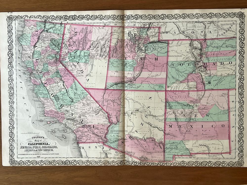
Colton, G. Woolworth – CALIFORNIA [WITH OTHER WESTERN STATES]. [From] Colton's General Atlas. New York. G.W. s C.B. Colton s Co. 1866. Litograph Map and Hand Coloured. 43,0 cm x 33,0 cm. Single. - Beautiful map of California and adjacent states of the American West, extracted from Colton's General Atlas of 1866. The year 1866 takes on particular significance for Californian cartography, as it is situated a scant seventeen years after the discovery of gold at Sutter's Mill (1849), an event that triggered the famous Gold Rush and radically transformed California, provoking one of the largest human migrations in American history. The map documents California in a phase of rapid development, showing the layout of principal routes, emerging cities, the mountain ranges of the Sierra Nevada and the vast plains of the Central Valley. The cartographic representation reflects the geographical knowledge accumulated during the years of the gold rush and subsequent colonization, when thousands of emigrants crossed the continent in search of fortune. The map also includes representations of neighboring states or territories such as Nevada, Oregon and parts of other western territories, whose exact boundaries were still in the process of definition at this time. Colton's cartography stands out for the clarity of its orographic representation, using hachures and shading to suggest mountainous relief, and for the careful coloring that distinguishes the different political entities. The hand-applied colors, in tones of pink, green, yellow and blue characteristic of Colton's production, give the map an aspect simultaneously informative and aesthetically pleasing. The surrounding decorative border, with its engraved geometric spiral arabesques, is typical of Colton's American maps. Maps of California from this period are particularly sought after by collectors, as they document a fascinating moment in American history, when the West still retained a character of frontier and unlimited possibility. The representation of pioneer routes, gold mines, newly founded cities and Indian territories constitutes a historical testimony of inestimable value. The map presents itself loose, in an individual sheet. The paper remains in generally good condition, with the natural browning of the years. The colors remain vivid and well preserved. A central fold crease is observed, common in these maps that were frequently folded for storage or transport. Slight scattered foxing and small moisture stains near the margins do not affect readability. The decorative border is complete. Ex-libris of Bernardo Brissos. Map of great interest for the history of American expansion to the West, an epic period in the formation of the United States.