Bidspirit auction | Colton, G. Woolworth – COLTON'S
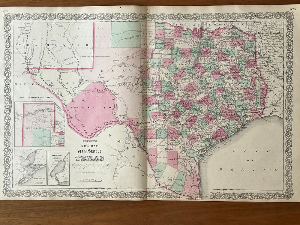
Colton, G. Woolworth – COLTON'S NEW MAP OF THE STATE OF TEXAS COMPILED FROM DE CORDOVA'S LARGE MAP. [From] Colton's General Atlas. New York. G.W. s C.B. Colton s Co. 1866. Litograph Map and Hand Coloured. 63,5 cm x 42,0 cm. Single. - Notable map of Texas extracted from Colton's General Atlas of 1866, representing the largest state in the Union (except Alaska) in a crucial period of its history. This map is based on the celebrated cartographic work of Jacob De Cordova, a Texan entrepreneur and promoter who in 1849 commissioned the first detailed map of Texas after annexation by the United States, working with Robert Creuzbaur, an official of the General Land Office of Texas. In 1855, Colton acquired the rights to De Cordova's map and proceeded to reissue and update it. The year 1866 is situated in the turbulent period of Reconstruction that followed the American Civil War, during which Texas, which had joined the Confederate States, faced the difficult task of reintegrating into the Union under federal military occupation. This edition is the first published after the end of the war and incorporates additional information about the western parts of Texas, reflecting the migratory wave of Southerners who abandoned the states devastated by war to rebuild their lives in Texas. The map documents the geography of Texas as it was known in the mid-nineteenth century, showing the principal rivers (Rio Grande, Brazos, Colorado, Red River), mountain ranges, counties, established cities, military forts, roads and the vast expanses of territory still sparsely populated. The Texas of 1866 already presented its current borders, definitively established after annexation by the United States in 1845 and the war with Mexico of 1846-1848. The extraordinary level of detail, showing counties, settlements, routes, railroads, rivers, mountains and German settlements, reflects the knowledge accumulated by military expeditions, by the Anglo-American and German colonists who established themselves in the state, and by the topographic surveys carried out in the preceding decades. Colton's cartographic representation distinguishes itself by the clarity in indicating the principal routes of communication, essential in a territory of continental dimensions, and by the careful coloring that distinguishes the different regions or counties. The hand-applied colors, in characteristic pastel tones, give the map a much appreciated decorative aspect. The ornamented border that surrounds the map exemplifies the taste of the period for decorative profusion. Maps of Texas from this period are particularly valued by collectors, as they document a state with a singular history: former Spanish colony, Mexican province, independent republic (1836-1845), American state, member of the Confederate States during the Civil War, and finally American state once again after Reconstruction. This complex history and the vast dimensions of the territory make Texas a fascinating cartographic subject. The map presents itself loose, in an individual sheet. The paper remains in good structural condition, with the uniform browning typical of age. The colors remain well preserved and vibrant. A fold crease is detected in the center, typical of these maps. Slight scattered foxing and small moisture stains on the margins do not compromise readability or aesthetic appreciation. The decorative border is intact. Ex-libris of Bernardo Brissos. Map of significant historical and cartographic interest, representing Texas at a crucial moment in American history. The rarity of this 1866 example, the first post-Civil War edition, makes it particularly sought after by collectors of Texan cartography.