Магазин Aviv gallery
|
Лот номер: 2693-122824
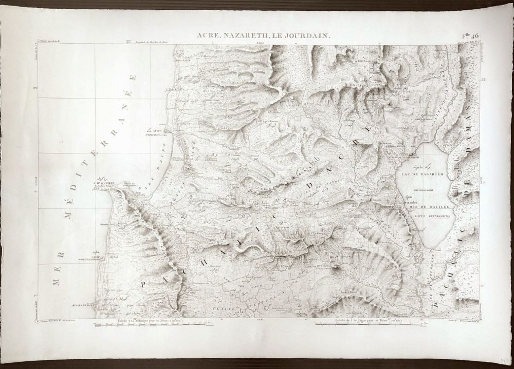
Engraved topographic map, Atlas Map 46 "Acre, Nazareth, Le Jourdain."
далее...
|
|
|
Цена:
$120
Цена включает налог и комиссию
|
Engraved topographic map, Atlas Map 46 "Acre, Nazareth, Le Jourdain."
Author: Jacotin, Pierre, 1765-1827; (France. Armee. Genie)
Date: 1826
Scale 1: 100,000
Engraved topographic map. The terrain is shown by hachures. Place names in French and Arabic.
Reference:
Nebenzahl, K. Maps of the Holy Land, pl. 60.
(Carte topographique de l'Egypte et de plusieurs parties des pays limitrophes ...) Flle. 46. Acre, Nazareth, Le Jourdain. Leve par M. Jacotin. Jacotin dirt. [1826] (Topographic map of Egypt and several parts of neighboring countries..)
Country: Israel, Palestine
Pub Title:
Description of Egypt or collection of observations and research that were made in Egypt during the French Army Expedition. Second edition. Dedicated to the King. Published by C.L.F. Panckoucke, Knight of the Legion of Honor. Geographic atlas. Paris, Imprimerie de C.L.F. Panckoucke. MDCCCXXVI.
| Размеры: | 91 x 63 см |
