Bidspirit auction | A historically important city map
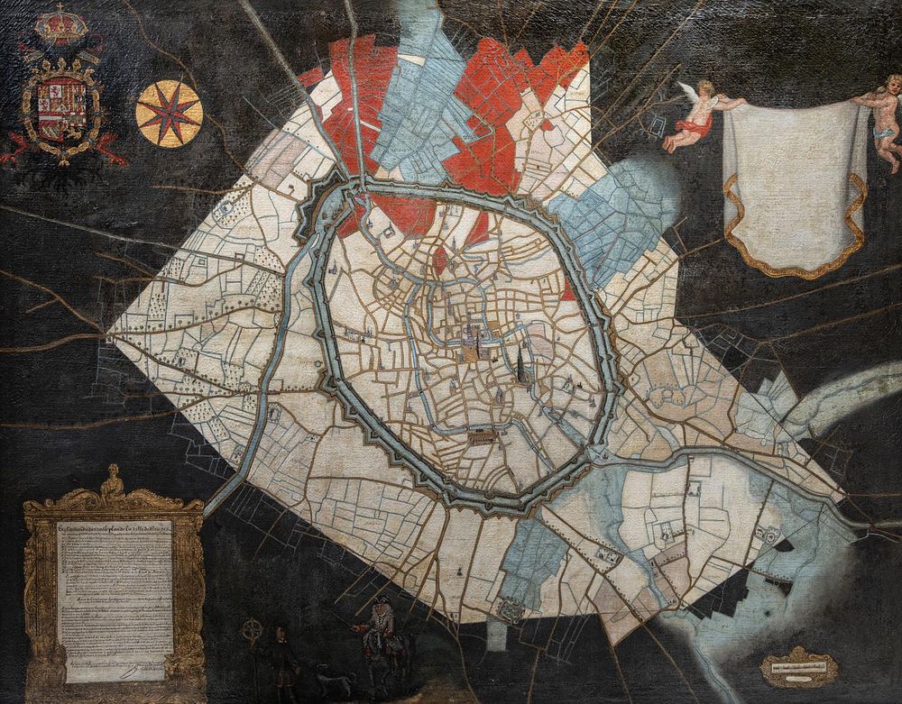
A historically important city map of Bruges, hand-painted by land surveyor Johannes Lobbrecht (fl.1690-1714), dated 1714, oil on canvas 162 x 206 cm. (63.78 x 81.09 in.), Frame: 168 x 210 cm. (66.14 x 82.68 in.) - A historically important city map of Bruges, hand-painted by land surveyor Johannes Lobbrecht (fl.1690-1714), dated 1714, oil on canvas The explanatory cartouche to the lower left is signed and dated 'Joan Lobbrecht, 1714'. Using a few main colours, the map shows the city of Bruges' diverse land use and feudal rights. The medieval city walls, with later fortifications, dominate the city's overview and topography. The most important monuments are indicated. A meeting of a horserider (the commissioner of the map) and the surveyor (Johannes Lobbrecht), both in typical Louis XIV costumes, is depicted on a green-grey background. The top left corner bears the client's coat of arms, decorated with a Golden Fleece. The scale and legend are placed in a gilt-decorated cartouche. The painting provides an important historical source for the topography of Bruges. The first version of the map dates from the year 1690, now in the collection of the Musea Brugge link text 162 x 206 cm. (63.78 x 81.09 in.), Frame: 168 x 210 cm. (66.14 x 82.68 in.) Provenance: Acquired from Axel Vervoordt in 1990.