Bidspirit auction | SEUTTER (Matthäus). PORTUGALLIA et ALGARBIÆ
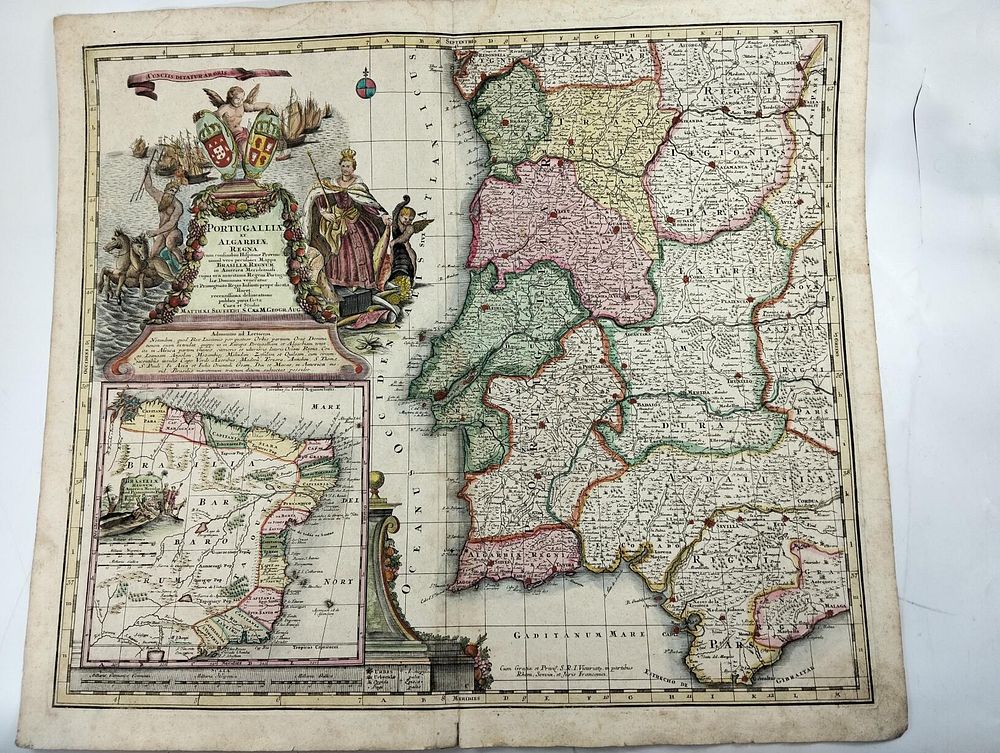
SEUTTER (Matthäus). PORTUGALLIA et ALGARBIÆ REGNA cum confinibus Hispaniæ Provinciarum, simul vero peculiari Mappa BRASILIA REGNUM in America Meridionali. Augsburgo. c. 1730–1740 - SEUTTER (Matthäus) PORTUGALLIA et ALGARBIÆ REGNA cum confinibus Hispaniæ Provinciarum, simul vero peculiari Mappa BRASILIA REGNUM in America Meridionali . Cujus ora maritima Regem Portugalliæ Dominum veneratur et Primogenito Regio Infanti prope dicata floret, recentissima delineatione publici juris facta. Augsburgo: Matthäus Seutter, c. 1730–1740. 1 gravura; 545x620 mm. A decorative and richly illustrated map of the territory of Portugal and the Algarve, with the provinces bordering Spain, accompanied by an inset map of the Kingdom of Brazil. Entitled Portugallia et Algarbiae Regna cum confinibus Hispaniae Provinciarum, simul vero peculiari Mappa Brasiliae Regnum in America Meridionali… , the map was produced by Matthäus Seutter , a geographer at the Austrian imperial court, working in Augsburg in the first half of the 18th century. The composition includes a sumptuous cartouche with the title surrounded by fruit, heraldic shields, allegorical figures and references to the maritime and colonial power of the Portuguese monarchy. The prominent inclusion of Brazil , presented as a separate and flourishing “regnum” under the rule of the King of Portugal and dedicated to the crown prince, clearly demonstrates the centrality of the colony in the imperial imagination of the time. The Portuguese territory is delimited by bright colors, with a road network, cities and well-defined administrative divisions. ! Please note that this translated text was generated by Google. !