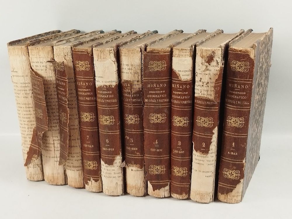
Bidspirit auction | MIÑANO (Sebastian de). DICCIONARIO Geografico-Estadistico
MIÑANO (Sebastian de). DICCIONARIO Geografico-Estadistico de España y Portugal. Madrid. 1826. - MIÑANO (Sebastian de) DICCIONARIO Geografico-Estadistico de España y Portugal . Madrid: Imprenta de Pierart-Peralta, 1826. 11 v.: il.; 210 mm. First edition of this monumental chorographic dictionary of the Iberian Peninsula, a work by Sebastián de Miñano y Bedoya (Madrid, 1779 - Paris, 1845), Spanish writer, journalist and geographer. A staunch Francophile, Miñano lived long periods of exile in France as a consequence of his sympathies for the Josephite regime; a multifaceted and erudite man, he is today considered one of the most interesting figures of early Spanish liberalism. ”This work represents an enormous task for a single man. The publication of this work earned the author his election to the Academy of History” (Palau, 1712-78). Miñano's Dictionary was the most important geographical and statistical dictionary of the Iberian Peninsula until the appearance of Pascual Madoz's Dictionary (1845-1850). It describes and analyzes more than 16,000 localities in Spain and Portugal, organized alphabetically in two columns, with information on population, agriculture, industry, topography, history, and ecclesiastical matters. The information was collected directly from parish priests and local authorities throughout the Peninsula, a method that, while giving it an unprecedented encyclopedic scope, was criticized by Fermín Caballero for the inevitable inequalities in quality and accuracy. It pays particular attention to coastal and port regions, reproducing maps of estuaries and ports of special cartographic interest. This copy is illustrated with 20 fold-out engravings, hand-colored at the time: maps, port and estuary plans, views and building plans. The detailed collation is as follows: Vol. 1: [6], 408 pp.; Vol. 2: [8], 492, [2 br.] pp., 2 maps ('Tierra de Batuegas' and 'Canary Islands'); Vol. 3: [6], 406 pp., 1 map ('Coruña, Betanzos y Ferrol'); Vol. 4: [6], 464 pp., 19 fold-out tables, 1 engraving ('View of Gibraltar'); 5th vol.: [6], 470 pp., 4 engravings ('Mapa Topographico del Partido de Ledesma', 'Real Museo de Pintura y Escultura', 'Plan de lo que puede ser à poca costa la plazuela de Oriente para que no desdiga del Real Palacio de SM', 'Real Observatorio del Buen Retiro de Madrid'); 6th vol.: [6], 518 pp., 2 maps ('Carta do Valle de Ména', 'Plano de Pasages y Suria'); 7th vol.: [6], 494 pp., 2 maps ('Plano de la Ria de Pontevedra', 'Plano de Portugalete y de su Fondeadero'); 8th vol.: [6], 486 pp., 1 table, 2 maps ('Plano de la Ria y Puerto de Santander', 'Plano del Puerto y Monte de Santoña'); 9th vol.: [6], 486 pp., 1 folding table, 2 maps ('Plano del Puerto de Valencia', 'Plano de la Ria de Vigo'); 10th vol.: [8], 112, 40 pp., 2 maps ('Plan de la Ria de Vivero', 'Plan that represents the state to which the Ciudad de Zaragoza reduced'); 11th vol. (Supplement, printed by Moreno, 1829): [2], X, 528 pp., 2 maps ('Plano de la Ria de Arosa', 'Plano de la Villa y Arsenal del Ferrol'). Rare and prized. ⚑ Auto-translated via Google Translate