Bidspirit auction | Antique Map – “Carte du
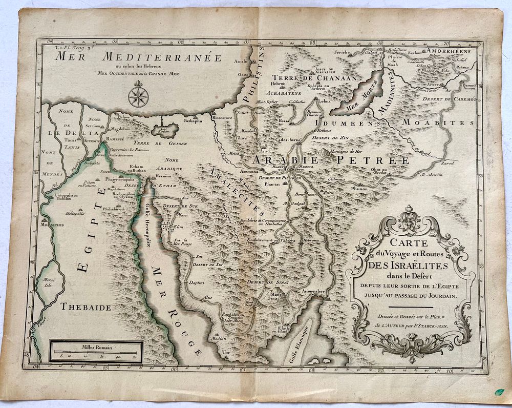
Antique Map – “Carte du Voyage et Routes des Israélites dans le Désert” | Antoine Augustin Calmet / P. Starckman | France, Early 18th Century - Beautiful and historically significant biblical map depicting the journey of the Israelites through the desert from Egypt to the Promised Land, according to the Book of Exodus. The full title reads: “Carte du Voyage et Routes des Israélites dans le Désert Depuis leur Sortie de L’Égipte jusqu’au Passage du Jourdain.” (Map of the Journey and Routes of the Israelites in the Desert, from their departure from Egypt to their passage over the Jordan River.) Drawn and engraved by P. Starckman, after the design by Antoine Augustin Calmet (1672–1757), the eminent French Benedictine scholar and biblical historian. The map was first issued for Calmet’s monumental Dictionnaire Historique, Critique, Chronologique, Géographique et Littéral de la Bible, published in Paris between 1720 and 1725. The engraving traces the biblical route of the Exodus, identifying the Israelites’ stations such as Rameses, Succoth, Pi-Hahiroth, Elim, Rephidim, Mount Sinai (Mont Oreb), Kadesh Barnea, Moab, and the Jordan River crossing. Geographic areas shown include Egypt, the Red Sea, the Arabian Desert, Edom, Moab, and Canaan. Decorated with an elegant Baroque title cartouche, the map combines theological scholarship with exquisite cartographic artistry. 📜 Author: Antoine Augustin Calmet (1672–1757) 🖋 Engraver: P. Starckman (sometimes attributed to J. F. Benard) 📗 Source: Dictionnaire Historique de la Bible, Paris, c.1720–1730 🗺 Subject: The Israelites’ Journey in the Desert 🖨 Technique: Copperplate engraving on laid paper 📏 Dimensions: approx. 50 × 39 cm 📑 Condition: Very good, strong impression, centerfold as issued, wide margins An exceptional early 18th-century biblical map, uniting faith, geography, and art — a classic representation of the Israelites’ journey through the wilderness.