Bidspirit auction | Eretz Israel and the Region
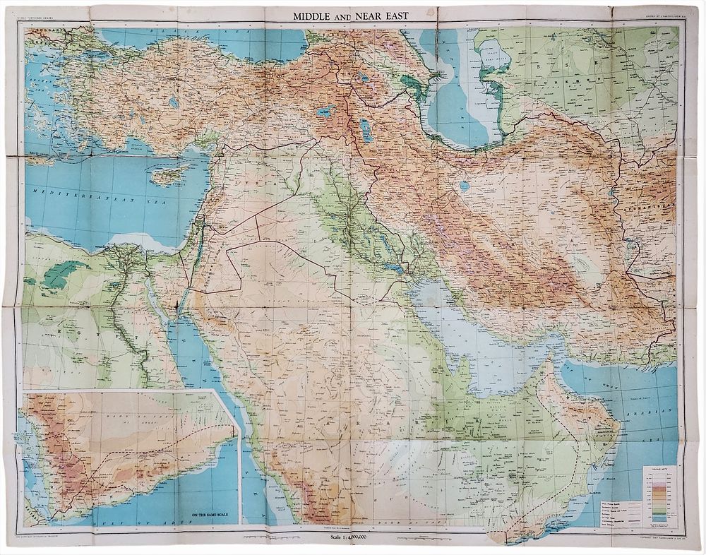
Eretz Israel and the Region | Middle East and Near East | Large Folded Cloth Map | Bartholomew | Scale 1:4,000,000 | c. 1930s–1940s | 99 × 76 cm - Large and impressive historical map of Eretz Israel and the surrounding region, issued as part of the World Layered Series by John Bartholomew & Son Ltd, Edinburgh. The map covers the Middle East and Near East in broad regional context, including Eretz Israel, Egypt, Syria, Lebanon, Iraq, the Arabian Peninsula, Turkey, Persia (Iran), the Caucasus, and the Aegean region. It is rendered in layered colour, with roads, political boundaries, and topographical features clearly indicated. Technical details: Scale: 1:4,000,000 Size (fully opened): approx. 99 × 76 cm Colour lithographic printing Folded map with original cloth cover Published in Great Britain (Edinburgh) Description: The map presents a detailed regional view with extensive place names, road networks, deserts, mountain ranges, and bodies of water. Eretz Israel is shown as an integral part of the wider Middle Eastern geography, reflecting British cartographic conventions of the period. The original cover bears the British Royal Coat of Arms and a reference to the appointment to King George V, assisting with period attribution. Condition – updated after inspection of photographed defect: Overall good condition for a map of this age, with expected signs of use and age. Original fold lines are present throughout, with light wear, mild edge wear, and scattered age toning. Notably, there is a distinct defect along the central vertical fold, consisting of paper wear and abrasion with exposed paper fibres and localized opening of the fold, clearly visible in the close-up photograph. This area shows structural weakness but does not result in major loss of printed content and does not significantly affect legibility. No major missing sections. The printed surface remains largely intact and readable, and the colours are well preserved with no excessive fading. Collector’s note: Folded cloth maps by Bartholomew at this scale, particularly those including Eretz Israel within a full Middle Eastern context, are sought after by collectors of historical cartography and British Mandate–era material. The described condition issue is fully reflected and suitable for professional stabilization or careful framing.