Bidspirit auction | Large and Important Collection of
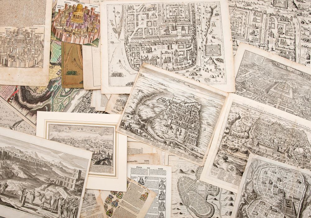
Large and Important Collection of Maps of Jerusalem – 15th-19th Centuries - Large collection comprising over one hundred maps depicting the city of Jerusalem and the Temple – woodcuts and engravings extracted from various atlases, travelogues, and scholarly works. Some hand-colored. [Europe, ca. 15th-19th centuries]. Among the maps: • Hierosolima, two incunabula leaves (on two separate sheets; leaf XVII) from the ”Nuremberg Chronicle” by Hartmann Schedel. [Nuremberg: Anton Koberger, 1493]. German edition. Imaginary view of Jerusalem with the Temple of Solomon at its center. Woodcut by Michael Wohlgemut. One leaf trimmed without text; illustration hand-colored. • The Temple of Solomon. Woodcut from the Luther Bible. [Württemberg, late 16th century]. German. • Die Heylige und Weltberuehmte Stadt Jerusalme, imaginary bird’s-eye view of Jerusalem by Dutch family of cartographers Visscher. From a mid-17th-century German Bible. German text on verso. • Novae Ierosolymae et locorum circumiacentium accurata imago. By Franciscus Quaresmius (1583-1656). [Antwerp, 1639]. • Ierusalem qualis (ut plurimum) extitit aetate Solomonis. Hand-colored engraved map. [London: John Williams press, 1650]. • L'ancienne ville de Jerusalem & ses environs, by Bernard Lamy. [Lyon?, ca. 1699]. • Hierusalem. Map of Jerusalem with the Temple at center, by Romeyn de Hooghe. [Amsterdam, 17th century]. • Ierusalem, et suburbia eius, sicut tempore Christi floruit. Engraved maps from various editions of the Civitates Orbis Terrarum, edited by Georg Braun and Franz Hogenberg, after Christian van Adrichem. [Ca. 17th-18th centuries]. • De Stadt Ierusalem zoot Hedendaeghs Bevonden wordt, by Olfert Dapper. [Amsterdam or Nuremberg, late 17th or early 18th century]. • Descriptio seu ichnographia veteris urbis Hierusalem et locorum adjacentium, by Bernard Lamy. [Paris, 1720]. • Ierusalem comme elle est a present, by Pierre Aveline (1656-1722). [Paris?, ca. 1723]. • Ofrandes des Prémices Portées au Temple de Jérusalem, by Augustin Calmet. [Holland, 1730]. • Prospectus sanctae olim et celeberrimae urbis Hierosolymae, by Matthaeus Seutter. Augsburg, [ca. 1734]. Latin and German. • Afbeeldinge der Stad Jerusalem. Engraved map by Dutch geographer and astronomer Willem Albert Bachiene (1712-1783). Gorinchem (the Netherlands): Nicolaas Goetzee, 1750. Engraved by Jan van Jagen. • A plan of the city of Jerusalem according to the description, by Emanuel Bowen. [Britain, ca. 1755]. • Plan de Jérusalem, by Claude Buy de Mornas. [Paris, 1761]. • And many others. Size and condition vary. Overall good to fair condition. Duplicates. The prints have not been thoroughly examined and are sold as-is.