Bidspirit auction | [ETIÓPIA-CARTOGRAFIA] CARTA DIMOSTRATIVA DELLA REGIONE
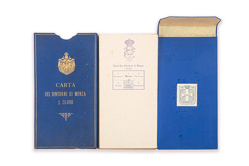
[ETIÓPIA-CARTOGRAFIA] CARTA DIMOSTRATIVA DELLA REGIONE COMPRESA FRA MASSAUA , KEREN, AKSUM E ADIGRAT. SCALA DI 1: 250.000. - ENG [ETIÓPIA-CARTOGRAFIA] CARTA DIMOSTRATIVA DELLA REGIONE COMPRESA FRA MASSAUA , KEREN, AKSUM E ADIGRAT. SCALA DI 1: 250.000. This map of the region between Massawa, Keren, Aksum and Adigrat is a fundamental historical map for the study of the Italian presence in East Africa. Here are the main details of the map: Publisher and date: It was published by the Istituto Geografico Militare (IGM) of Florence in 1887. Content: The map covers the northern area of present-day Ethiopia (Tigray region) and the central part of Eritrea, including strategic centers such as Massawa, Keren, Aksum and Adigrat. Historical context: It was created during a period of Italian colonial expansion, shortly after the occupation of Massawa (1885) and together with the first expeditions into the interior, such as those linked to the reoccupation of Saati. On these maps one can see curious comments about some unknown regions... It was used by the 1st King of Italy and has a protective case in blue cloth with gold embossing, on which the royal coat of arms of Italy can be seen, engraved for the King. The protective case bears the number 4689 of the royal library of His Majesty King Vittorio Emanuele III. PERFECT STATE OF PRESERVATION. RARE 19TH-CENTURY MAPS. FR [ETIÓPIA-CARTOGRAFIA] CARTA DIMOSTRATIVA DELLA REGIONE COMPRESA FRA MASSAUA , KEREN, AKSUM E ADIGRAT. SCALA DI 1: 250.000. Cette carte de la région entre Massawa, Keren, Aksum et Adigrat est une carte historique fondamentale pour l’étude de la présence italienne en Afrique orientale. Voici les principaux détails de la carte : Éditeur et date : elle a été publiée par l’Istituto Geografico Militare (IGM) de Florence en 1887. Contenu : la carte couvre la zone nord de l’Éthiopie actuelle (région du Tigray) et la partie centrale de l’Érythrée, incluant des centres stratégiques comme Massawa, Keren, Aksum et Adigrat. Contexte historique : elle a été réalisée pendant une période d’expansion coloniale italienne, peu après l’occupation de Massawa (1885) et conjointement avec les premières expéditions vers l’intérieur, comme celles liées à la réoccupation de Saati. Sur ces cartes, on peut voir des commentaires curieux sur certaines régions inconnues... Elle fut utilisée par le 1er roi d’Italie et possède un coffret de protection en toile bleue avec des impressions dorées, sur lequel on voit les armoiries royales de l’Italie, gravées pour le roi. L’étui de protection porte le numéro 4689 de la bibliothèque royale de Sa Majesté le roi Vittorio Emanuele III. ÉTAT DE CONSERVATION PARFAIT. CARTES RARES DU XIXᵉ SIÈCLE. CN [ETIÓPIA-CARTOGRAFIA] CARTA DIMOSTRATIVA DELLA REGIONE COMPRESA FRA MASSAUA , KEREN, AKSUM E ADIGRAT. SCALA DI 1: 250.000. 这幅描绘 Massawa、Keren、Aksum 与 Adigrat 之间地区的地图,是研究意大利在东非存在情况的一份基础性历史地图。以下是该图的主要信息:出版者与日期: 由佛罗伦萨的 Istituto Geografico Militare (IGM) 于 1887 年出版。 内容:地图涵盖了当今埃塞俄比亚北部地区(提格雷地区)以及厄立特里亚中部地区,包括 Massawa、Keren、Aksum 和 Adigrat 等战略要地。 历史背景:该图绘制于意大利殖民扩张时期不久,在占领 Massawa(1885 年)之后,并与第一次深入内陆的远征同时进行,例如与重新占领 Saati 有关的行动。在这些地图上,可以看到关于某些未知地区的有趣注释…… 此图曾供意大利第一任国王使用,并配有一只蓝色帆布护盒,上有金色压印,可见为国王雕刻的意大利王室纹章 。护盒上有编号 4689,为陛下 Vittorio Emanuele III 国王御用皇家图书馆的编号。保存状况完美。十九世纪罕见地图。