Bidspirit auction | Joan Blaeu (1596-1673), Map of
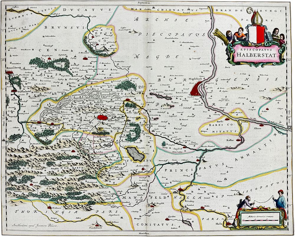
Joan Blaeu (1596-1673), Map of the Diocese of Halberstadt - partially colored copperplate engraving on paper, around 1650, figurative title cartouche ”Episcopatus Halberstat” upper right, figurative cartouche for the mile marker lower left, text excerpt on the reverse, The detailed map covers the area between Braunschweig, Tangermünde, Halle, and Goslar. Several towns are depicted as small views with church towers and fortifications, Amsterdam, center fold, age-appropriate condition, somewhat browned and stained, some creases and wormholes, thinned area with three holes in the upper left next to the center fold, image 43 x 53.5 cm (HxW), overall dimensions 55 x 65 cm (HxW) German Description Joan Blaeu, Landkarte des Bistums Halberstadt Niederländischer Kartograf (1596 - 1673), teilkolorierte Kupferstichkarte/Papier, um 1650, oben rechts figürliche Titelkartusche ”Episcopatus Halberstat”, unten links figürliche Kartusche für den Meilenzeiger, Verso Textauszug, Die detailreiche Karte umfasst das Gebiet zwischen Braunschweig, Tangermünde, Halle und Goslar. Einige Städte sind als kleine Ansichten mit Kirchtürmen und Befestigungen wiedergegeben, Amsterdam, Mittelbug, altersgemäßer Zustand, etwas gebräunt und fleckig, partiell Knickspuren und Wurmfraßlöchlein, oben links neben dem Mittelbug ausgedünnte Stelle mit drei Löchern, Darstellung 43 x 53,5 cm (HxB), Gesamtmaß 55 x 65 cm (HxB)