Bidspirit auction | Berg, Carl. Flood Map: City
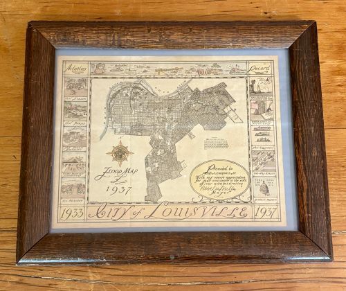
Berg, Carl. Flood Map: City of Louisville 1933-1937. City of Louisville, 1937. 14.5”X12” - This framed commemorative document and map, titled Flood Map 1937 and City of Louisville 1933-1937, features a central map of Louisville, Kentucky, highlighting the areas affected by the Great Flood of 1937. The map was delineated by Carl Berg, as indicated by the text Carl Berg, Del. in the lower left corner. The document includes a decorative presentation cartouche hand-inscribed to Mr. B. J. Campbell, Jr, with a printed facsimile signature by Neville Miller, Mayor. The borders are decorated with vignettes illustrating the achievements of the municipal administration; the left side, titled Activities, depicts urban improvements such as New Streets, New Parks, New Public Buildings, Grade Crossing Eliminations, and New Housing. The right side, titled Record, details administrative achievements including Gas, Electric and Telephone Rate Cases, Governmental Efficiency, New Equipment, and One-Way Streets. A section for Federal Projects lists various New Deal agencies including FERA, KERA, CWA, PWA, WPA, and NYA. The top border is titled Flood Memories and depicts various rivercraft and relief efforts. A map legend provides statistical data on the flood's crest and duration. The item is housed in a dark-stained wood frame under glass.