Bidspirit auction | T.G. Bradford & Julius Bien
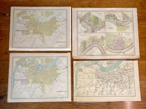
T.G. Bradford & Julius Bien & Co. 19th C. Hand-Colored Maps of Louisville, Kentucky & Other Cities - This collection comprises several 19th-century hand-colored lithograph and engraved maps, primarily documenting the geography of Louisville, Kentucky. The group includes two street maps of Louisville, identified as plate 118 and plate 122, featuring yellow-tinted city grids. Also included is a detailed military survey titled Louisville and its Defenses, dated June 1865 and lithographed by Julius Bien and Company of New York. Another sheet contains four inset city maps of Washington, Louisville and Jeffersonville, New Orleans, and Cincinnati, bearing an 1838 copyright by T.G. Bradford. Two of the sheets feature maps of Indianapolis on the reverse side. The plates contain detailed printed cartographic attributions, publisher credits, and plate numbers.