Bidspirit auction | Early World Map, based on
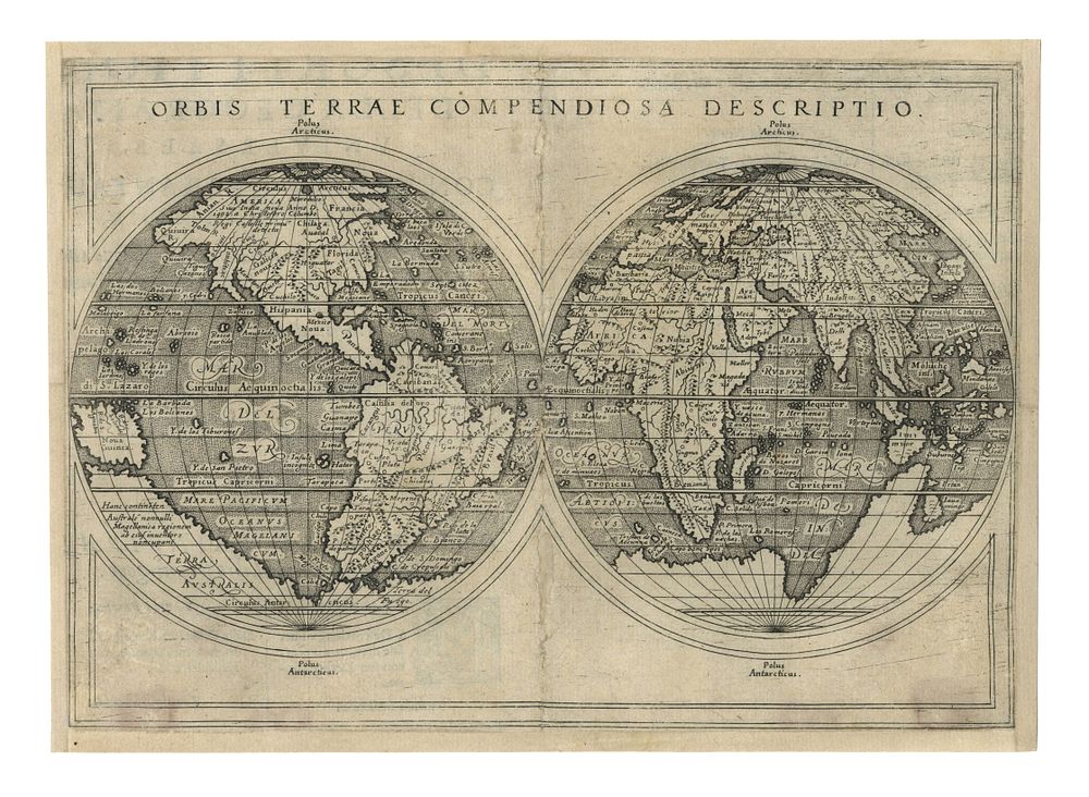
Early World Map, based on Rumold Mercator’s 1587 map, published in Rosaccio’s 1598 Geographia & Lasor a Varea’s 1713 Universus Orbis - A rare and fascinating early map of the world, first published in the 1598 edition of Ptolemy's Geographia by Rosaccio and later re-issued by Lasor a Varea in their 1713 work Universus Terrarum Orbis Scriptorum. This map is based on Rumold Mercator's 1587 world map but is distinguished by its use of parallel latitudes, offering a unique perspective of the globe. The depiction of North America closely mirrors the style seen in Zaltieri/Lafreri maps, particularly in its striking representation of the northwest coast. Notably, the map features a large and prominent Terra Australis, as well as intriguing early representations of the Northwest and Northeast Passages, alongside a detailed view of Asia. Of particular interest, this map predates the groundbreaking explorations of Le Maire and Schouten, who, in rounding Cape Horn, established the existence of open water south of Tierra del Fuego and the Straits of Magellan. The map has undergone restoration, including the addition of a new margin and repairs to the centrefold line. Shirley 217. Size of sheet 18.5 cm (height) x 25.5 cm (width), 7.2 x 10 inch.