Bidspirit auction | Plan Tres Exact De La
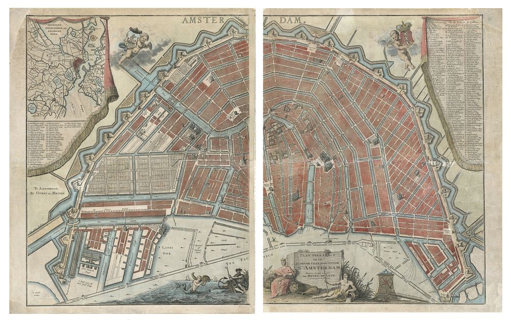
Plan Tres Exact De La Fameuse Ville Marchande D'Amsterdam by Hendrick De Leth, c.1735 - This magnificent large-format engraved map of Amsterdam, titled ”Plan Tres Exact De La Fameuse Ville Marchande D'Amsterdam,” was published by Hendrick de Leth in Amsterdam circa 1735. The map highlights Amsterdam's iconic canal-divided urban plan, with city blocks clearly delineated and key public buildings illustrated pictorially. Surrounding the city are fortifications and its famous windmills, all carefully named and engraved. At the bottom of the map, an allegorical cartouche celebrates the city's maritime wealth and its prominent position in Europe, with figures symbolizing the bounties of the sea and the power of Amsterdam. A key in the upper-left and -right corners identifies 139 points of interest, corresponding to numbered locations on the map. Additionally, an inset regional map titled ”Caarte van Amstelland” situates Amsterdam within its broader geographical context. Great for collectors of Amsterdam, Hendrick de Leth, antique map, 18th-century maps, canal maps, city plans, historical maps, allegorical cartouche. Condition: The map has been restored to repair tears. Two holes have been restored and manuscript repairs added. had a considerable restoration to repair cracks, with the left corner of the left sheet and the upper-right corner of the right sheet restored. Backed on Japanese paper. Size (Right sheet): 57.5 x 44 cm (22.6 x 17.3 inches); Size (Left sheet): 57.5 x 44.5 cm (22.6 x 17.5 inches).