Bidspirit auction | 18th Century Map of the
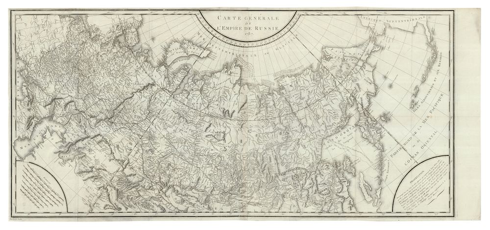
18th Century Map of the Russian Empire by Peter Simon Pallas, 1787 - A large and detailed two-sheet map of the Russian Empire, titled Carte Générale de l'Empire de Russie 1787, published in Paris between 1788-93 by Maradan. The map was engraved by P.F. Tardieu for Peter Simon Pallas's Voyages en différentes provinces de l'Empire de Russie, the French edition of his Reise durch verschiedene Provinzen des Russischen Reichs, first published in St. Petersburg between 1771 and 1776. This significant map covers the vast expanse of the Russian Empire in the late 18th century. Pallas (1741-1811), a Prussian botanist and zoologist, led an expedition across remote regions of Russia, collecting specimens for Catherine II. Condition: good, with narrow margins on three sides and flattened binding folds. Size: The map is presented on two conjoined sheets, measuring 56 x 117.5 cm (22.05 x 46.26 inches). Keywords: Russian Empire map, Peter Simon Pallas map, 18th century map, Russian cartography, historical map, Pallas expedition map, antique world map, map of Russia, early Russian exploration, French edition map, map of Russia 1787.