Bidspirit auction | Ungaria Occidentale & Ungaria Orientale
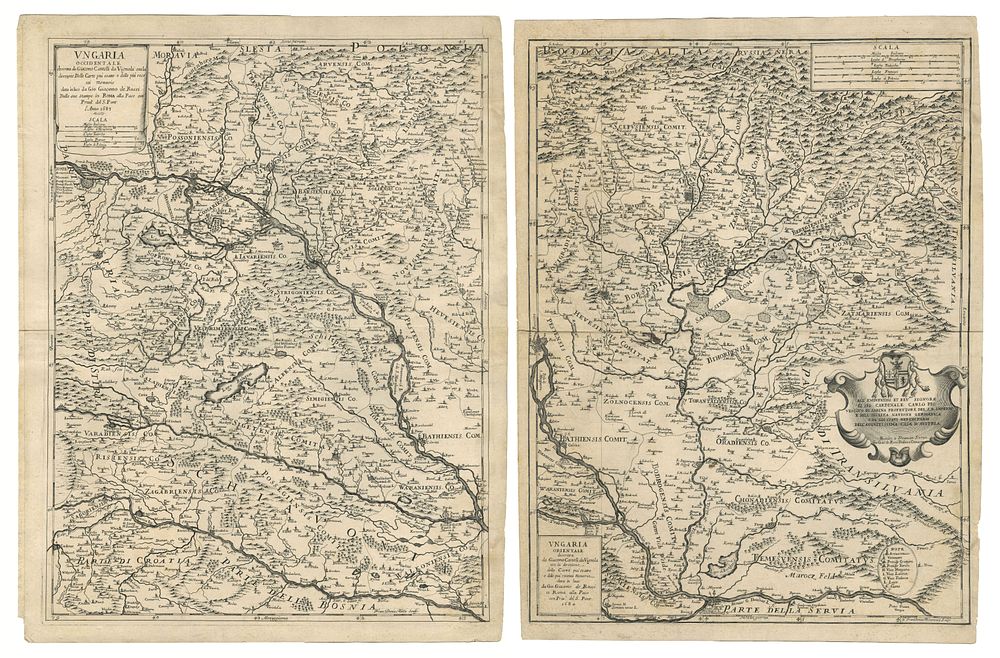
Ungaria Occidentale & Ungaria Orientale by DE ROSSI, Giovanni Giacomo. - A scarce pair of maps of Hungary and its adjoining regions, published by Giovanni Giacomo De Rossi. The first map, Ungaria Occidentale, focuses on modern-day Hungary and Slovakia, extending to include parts of western Romania, northern Croatia, and eastern Austria, with notable detail on mountain ranges, rivers, and principal settlements such as Vienna and Cluj-Napoca. The second map, Ungaria Orientale, covers the eastern regions, extending to Transylvania, the Carpathian Mountains, and the Danube River, with further detail on Slovakia and parts of Austria. Size: Right sheet (Ungaria Orientale): 58 x 44 cm (22.8 x 17.3 inches). Left sheet (Ungaria Occidentale): 60 x 44.5 cm ( 23.6 x 17.5 inches). condition: Signs of wear; strong impressions. Mounted on thick paper. Published: Rome, 1683-1684 De Rossi. Keywords: Giovanni Giacomo De Rossi maps, antique Hungary maps, 17th-century cartography, Transylvania maps, Slovakia historical maps, Vienna map 1680s, Rossi maps Rome, decorative antique maps, Central Europe cartography, Ungaria Occidentale, Ungaria Orientale.