Bidspirit auction | Ligon - Map of Barbados
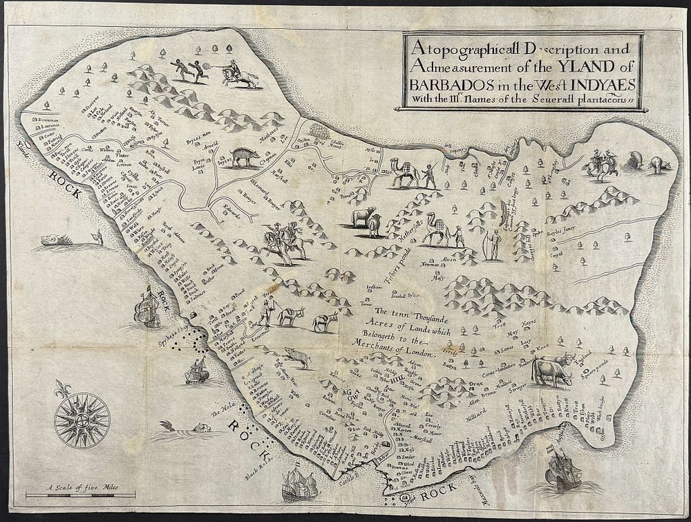
Ligon - Map of Barbados (A Topographicall Description and Admeasurement of the YLAND of BARBADOS in the West INYDAES With the Mr.s names of the Severall plantacons) - This first edition, engraved map from Richard Ligon is entitled A Topographicall Description and Admeasurement of the YLAND of BARBADOS in the West INYDAES With the Mr.s names of the Severall plantacons . The map was published as part of Ligon's work True and Exact Historie of the Island of Barbadoes . The work was published in London by Humphrey Moseley in 1657. This is the earliest printed map dedicated exclusively to the island of Barbados. The map is detailed with camels, chivalric knights on horseback, stylized figures of indigenous men, as well as cows, boars, and sheep. Ligon based the map on information from Captain John Swan, the leading surveyor of the island at the time. The outline is pretty accurate, though a third longer than correct length. There are 285 plantations identified by the owner's name. Fortifications are shown at Carlisle Bay protecting the main island location of Bridgetown. Near the center of the island is notated “the tenn Thousande Acres of Lande which Belongeth to the Merchants of London.” This referenced the lease of the land to Lord Carlisle after Sir William Courteen's grant was rescinded by Charles I. Most of the animals depicted were brought to the island by English settlers. The boars were introduced by the Portuguese people. While camels were useful on the plantations, Ligon noted, “several planters imported these beasts and found them useful in Barbados, but did not know how to diet them.” Paper Size: ~ 21” by 15 1/8” (Fold Out) Paper Type or Special Features: Engraving