Bidspirit auction | Dawes & Hunter - Map
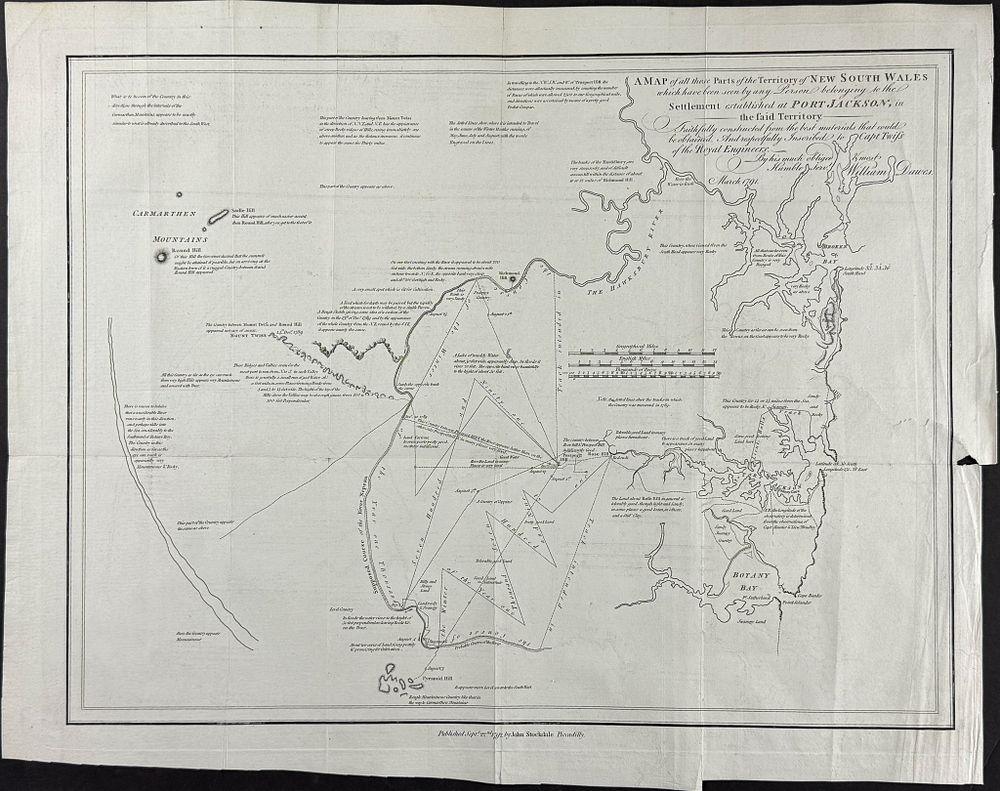
Dawes & Hunter - Map of New South Wales, Australia or New Holland [A Map of all those Parts of the Territory of New South Wales which have been seen by any Person belonging to the Settlement established at Port Jackson, in the said Territory] - This early, first edition Australian regional map is by William Dawes. It is entitled ”A Map of all those Parts of the Territory of New South Wales which have been seen by any Person belonging to the Settlement established at Port Jackson, in the said Territory.” It was published as part of John Hunter's An historical journal of the transactions at Port Jackson and Norfolk Island, with the discoveries which have been made in New South Wales and in the Southern Ocean. The work published in London by J. Stockdale in 1793. This map illustrates the first exploration of the Sydney basin. William Dawes (1762-1836) was a British Royal Marine officer, surveyor, engineer, astronomer, botanist, and explorer. He sailed on the Sirius in the First Fleet to Botany Bay in 1788. He surveyed the then new town of Sydney. Dawes Point is named after him. John Hunter (1737-1821) was an English Naval officer. He was part of the First Fleet that sailed to Australia in 1787. This was the British expedition to establish a penal colony under the command of Arthur Phillips. He eventually became the second Governor of New South Wales. ”With his [Hunter] encouragement, the exploration of the coastline of Australia made rapid progress, and the early discoveries of Flinders and Bass owe much to him. His journal is a very valuable work on the early history of the English settlement in Australia.” (Hill) Paper Size: ~ 23 3/4 - 24” by 18 1/2” (Fold Out) Paper Type or Special Features: Engraving