Bidspirit auction | De L'Isle - Map of
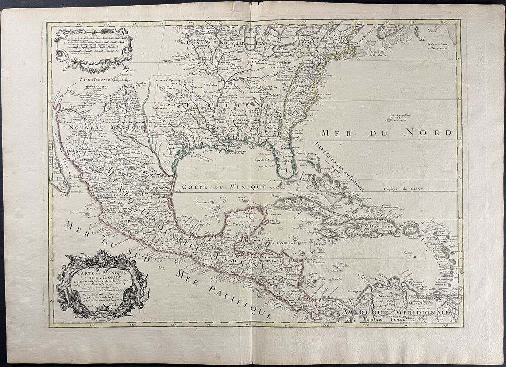
De L'Isle - Map of Southern North America with Florida, Mexico, West Indies or Caribbean, Louisiana, part of Great Lakes - This engraved map from Guillaume de l'Isle is entitled Carte du Mexique et de la Floride des Terres Angloises et des Isles Antilles... . It was published in Paris between 1703 and 1708. The map depicted much of southern North America with great detail to Mexico, Florida, and the Mississippi River. It was the first printed map to accurately depict the course and mouth of the Mississippi River. It depicts the region from the Great Lakes in the north to New Mexico, and extends south to Panama, Venezuela, and the Caribbean. It indicates the locations of numerous Native American tribes and villages, as well as many French and English forts. The map features a title cartouche by Charles Louis Simonneau in the lower left corner and a mileage scale cartouche at the top. It was the first map to correct the longitudes of America, to remove the long-held error of depicting California as an island, to properly chart the Mississippi Valley, and to introduce many new place names. Homann, Seutter, and Lotter drew from this map to create their examples. br>Guillaume de l'Isle (1675-1726) was son of a cartographer and a pupil of Jean Dominique Cassini, who among other important contributions, aligned the study of astronomy to the study of geography. Under Cassini's direction, observations were made from locations all over the world that enabled longitudinal calculations to be made with much greater accuracy. De l'Isle carried on this exacting work with remarkable dedication and integrity, constantly revising and improving his maps. While precision was his primary goal, his maps are invariably elegant and attractive. He also served as the Royal Geographer to the King of France. Paper Size: ~ 21 5/8” by 31 1/8” Paper Type or Special Features: Engraving with Original Outline Color